Summary of applications
1,450 new homes in a highly sustainable location on the edge of Oxford, including 50 per cent (725) new affordable homes (Social Rent, Affordable Rent, Shared Ownership and First Homes) to contribute to meeting Oxford’s current housing shortage.
120 assisted living homes, including 50 per cent (60) affordable assisted living homes.
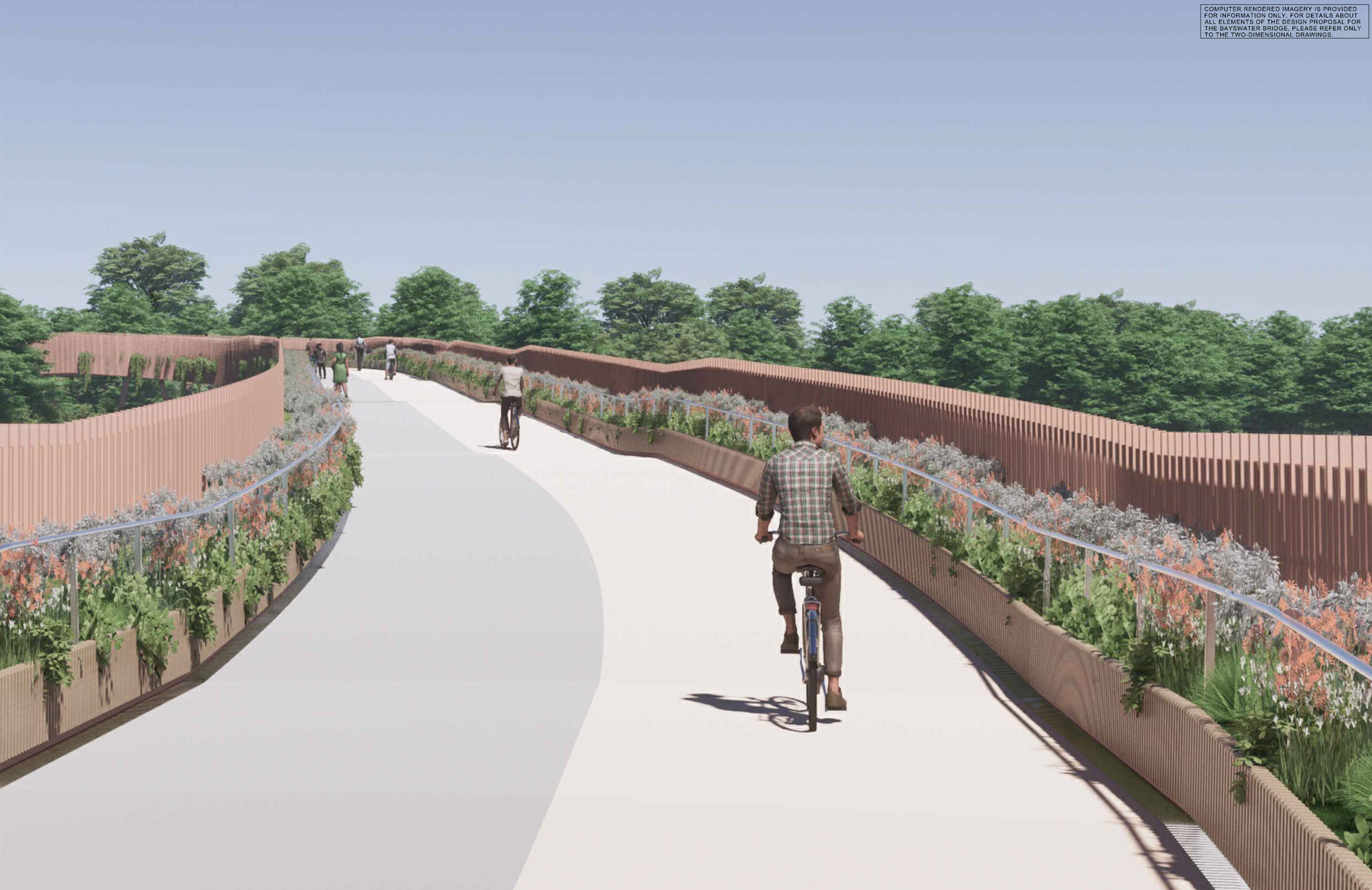
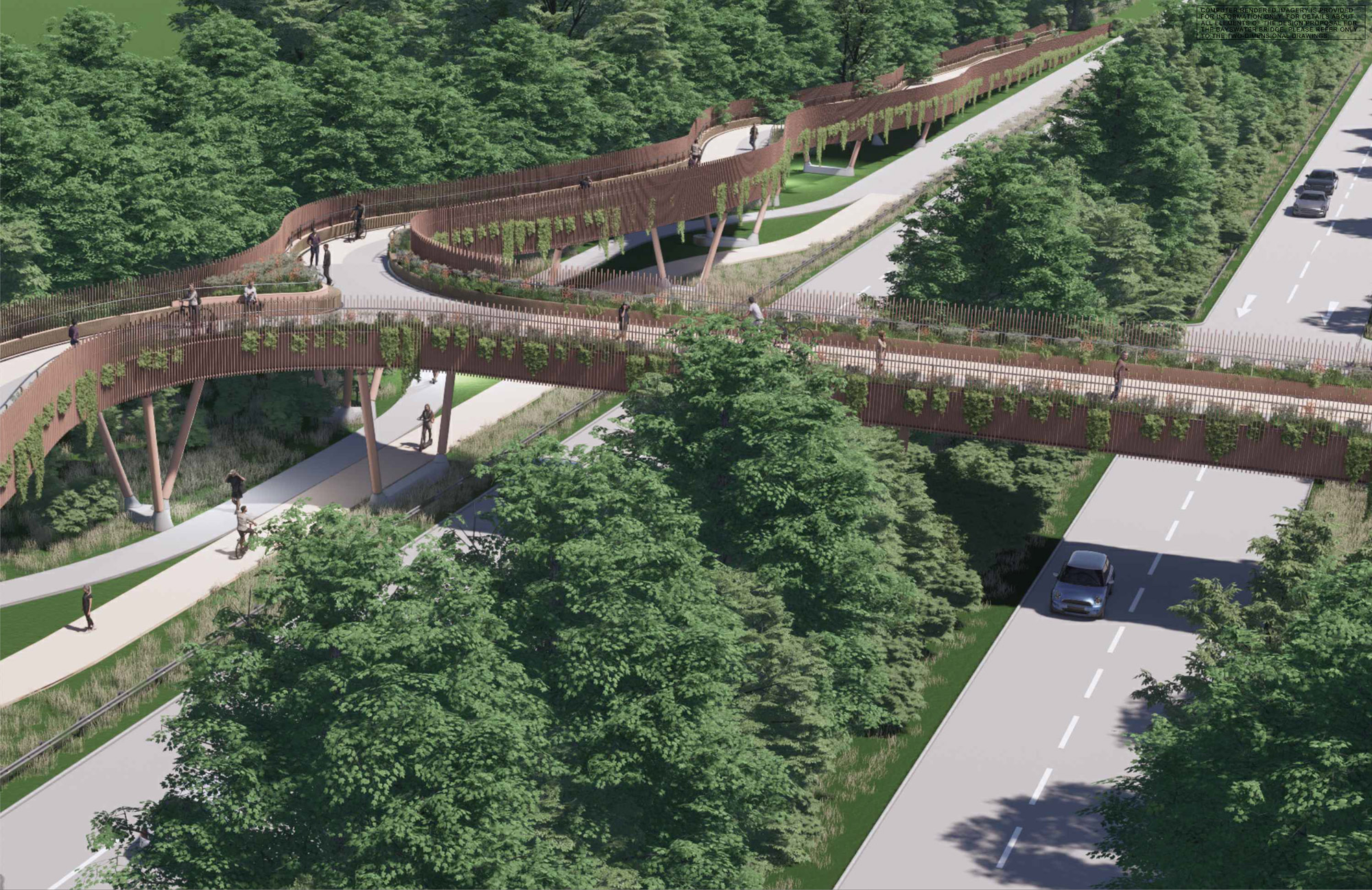
A new pedestrian/cycle bridge over the A40 providing a safe connection across the dual carriageway.
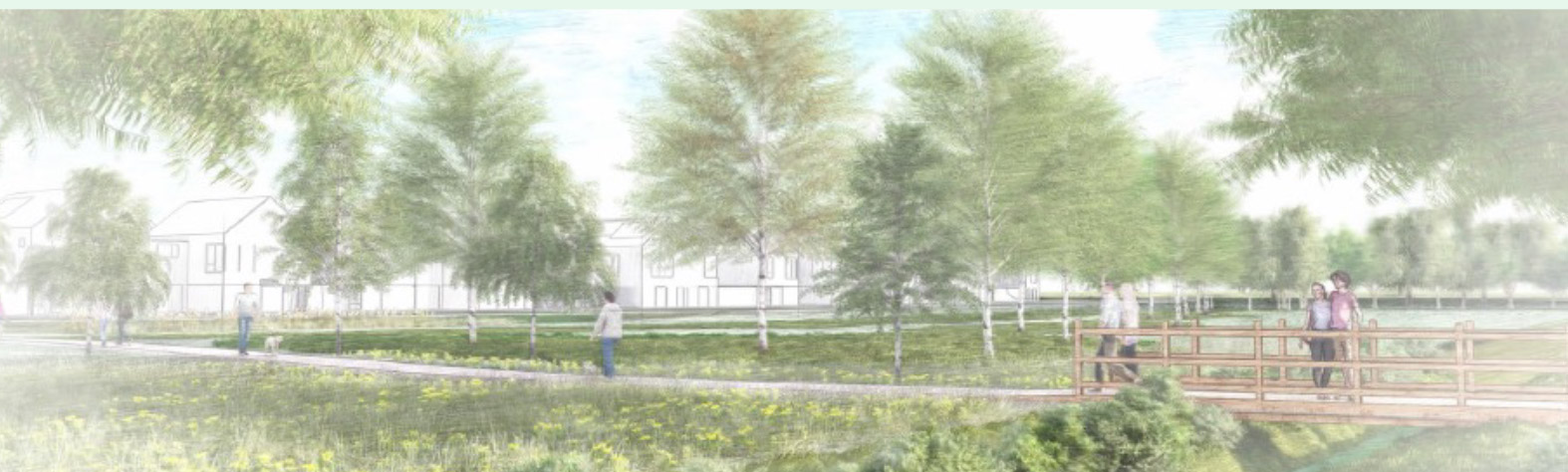
65 hectares of Green and Blue Infrastructure including new recreation, amenity and public open space and new recreational routes and ecological habitats.
Over 10% net gain in biodiversity across the site.
A new primary school plus nursery provision.
Contributions towards the expansion of secondary and Special Educational Needs education.
Onsite provision/or financial contributions to expand local health care services.
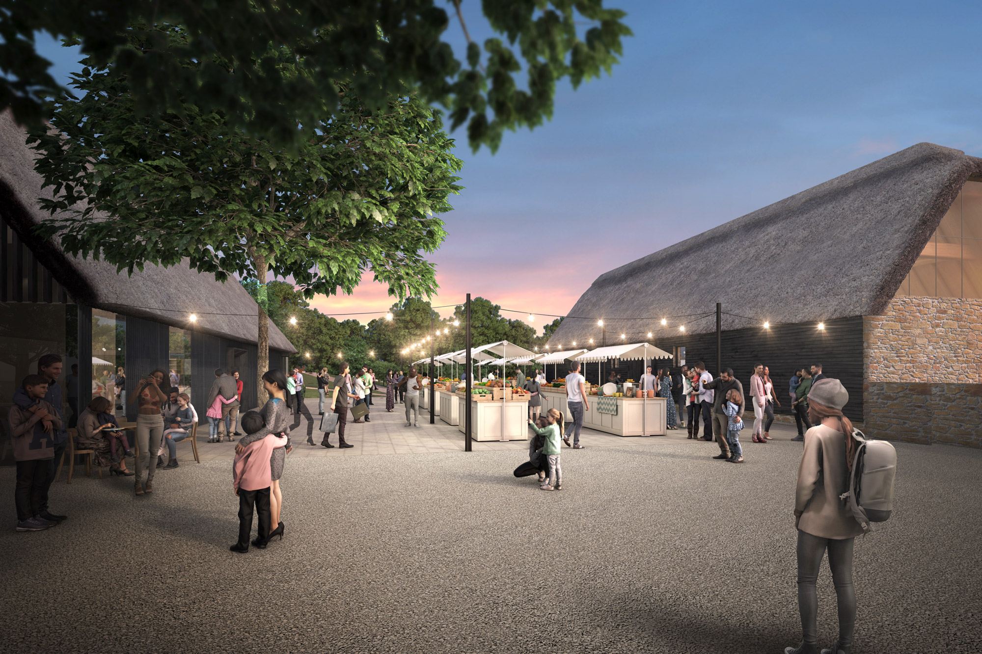
A mixed-use local centre with new local retail.
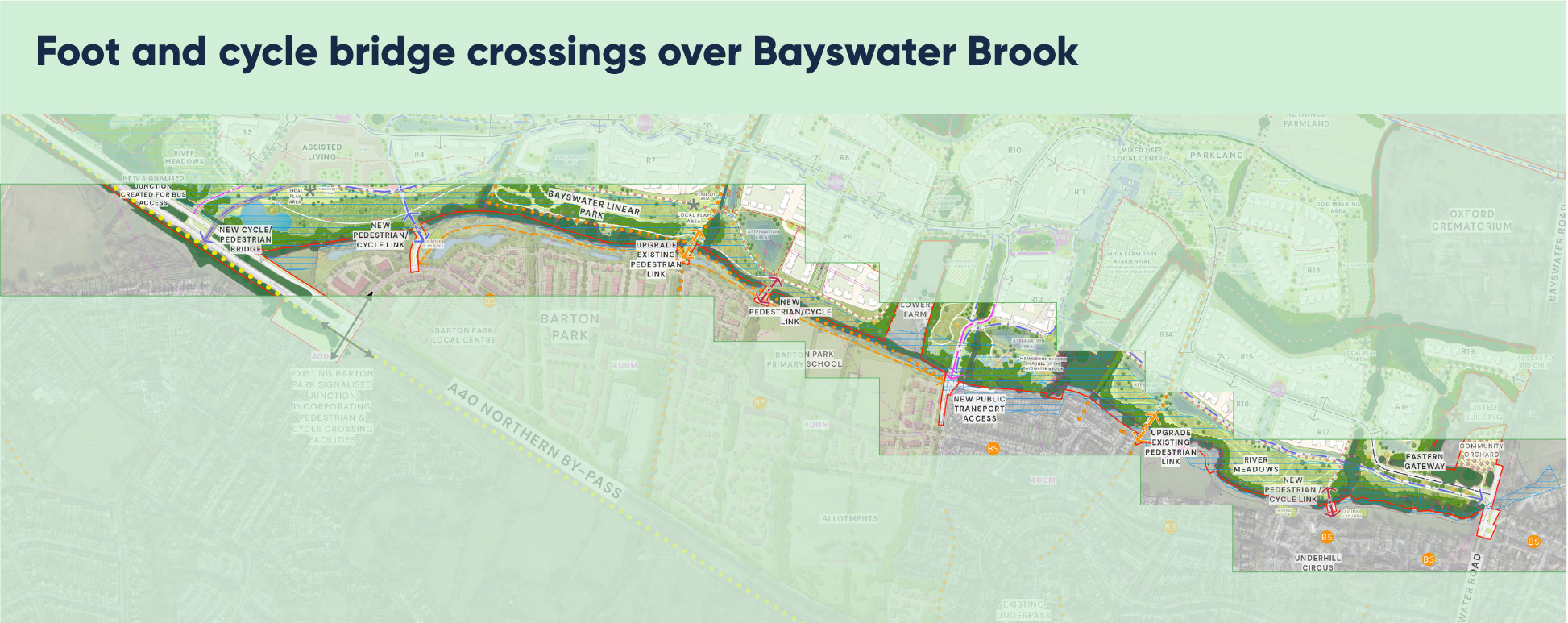
New and upgraded bridge crossings over the Bayswater Brook to integrate existing and new communities.
Creation of additional floodplain storage on site and the delivery of an exemplary surface water drainage scheme.
Measures to help alleviate existing flooding issues for homes on Barton Village Road.
Planting over 15,000 new trees.
In addition, our plans ensure:
Extensive care and consideration are given into protecting and managing Sydlings Copse & College Pond SSSI, including through creating substantial new amenities and leisure opportunities away from the SSSI;
An overall increase in the number of native woodland trees and hedgerows on the site; and
Socio economic opportunities including over 470 temporary jobs per year during construction and approximately 100 full time equivalent jobs created through the new local centre, community hubs and primary school once built.

Click to enlarge
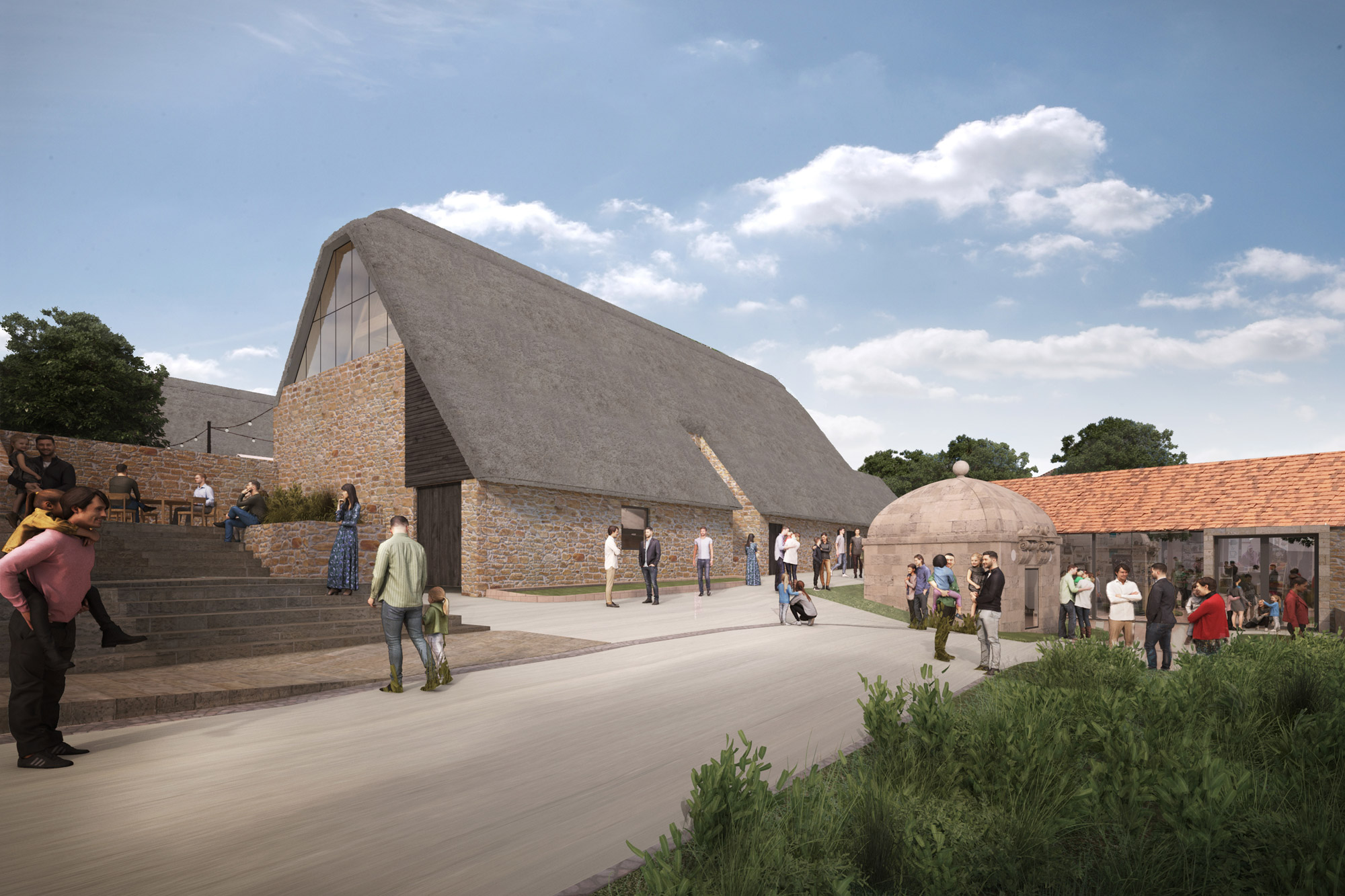
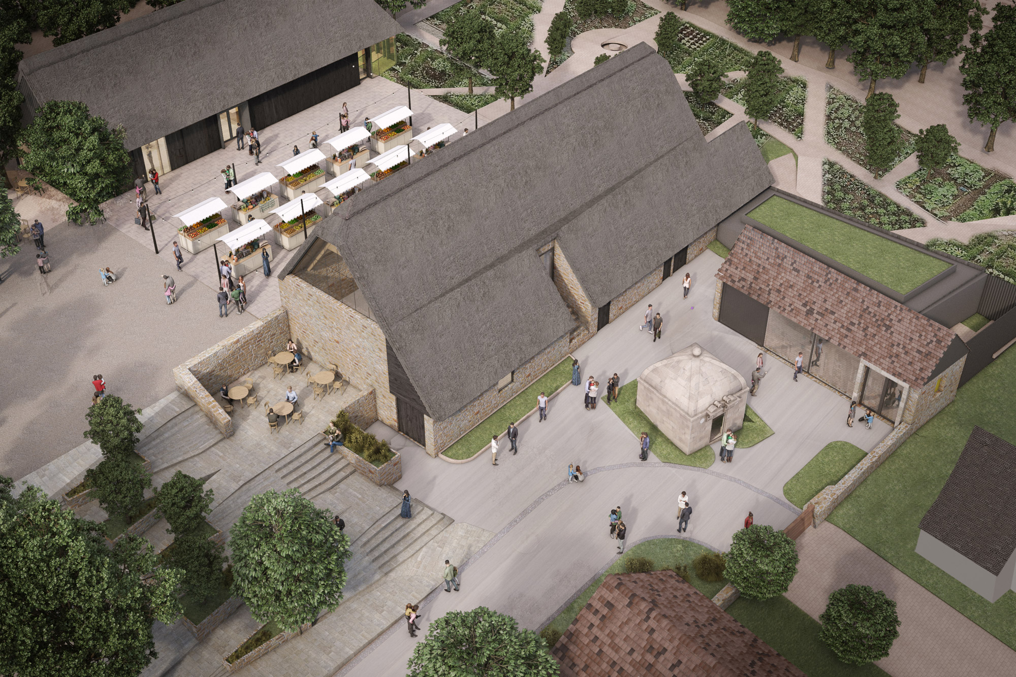
Wick Farm proposals
A key part of our proposals is the creation of a mixed-use local centre, bringing back to life the historic buildings at Wick Farm. Our plans at Wick Farm include:
- A café and space for a bar or restaurant
- Cycle shop
- Community centre
- A potential public art gallery space in the old Well House
- A retail unit
- Co-Working hub
- Market garden
- New public realm courtyards
- Adjoining facilities for children including a neighbourhood play area and children’s cycle track
We seek to build upon Wick Farm’s distinctive character and history to create a social community hub at the heart of the wider development. The vision includes:
- Putting well-being at its core, this means integrating the community hub with the wider landscape and improving access to outdoor leisure;
- Creating versatile indoor and outdoor spaces which are accessible to all;
- Being environmentally sustainable, with careful consideration around construction and materials to on-site renewable energy and food production; and
- Encouraging travel by active modes of transport
Making new connections
Bayswater has been designed to promote sustainable travel options, rather than just creating more road for cars. Our goal is to create an exemplar development that will prioritise walking, cycling and public transport.
Bayswater has been designed to follow emerging transport policies promoting active travel, over the use of the car. This will ensure the development is consistent with Oxfordshire County Council’s aspiration to restrict traffic growth in Oxford over the next decade and reduce car use.
Pedestrian and cycle connections
A new pedestrian/cycle bridge over the A40 will provide a much-needed safe route over the A40, connecting Bayswater and its immediate neighbours with a wider cycle network in the local area and on into Oxford. This connection will provide access to local services and facilities as well as an onward route to Oxford City Centre.
New and upgraded cycle and pedestrian crossings are also planned to make it easy to cross the Bayswater Brook.
Key elements for pedestrian and cycle connections include:
- 19 km of cycle paths
- Segregated pedestrian and cycleways for key movement routes
- Low/ no car routes creating family friendly connections to areas such as the primary school
- Existing footpaths and bridleways will be retained as part of the proposals
Public transport
There are two dedicated public transport access points for the site, for a new bus route that will pass through the centre of the site via the new Main Street, with dedicated bus access from the A40. The bus route will then connect to the new local centre, before exiting onto Barton Village Road.
The use of the public transport only access points will mean that buses can move freely through the site, creating efficient connections to local services and residential areas.
Public transport provision will be accompanied by five mobility hubs at key locations along the Main Street which will help to integrate public transport with active modes of travel.
Provisions for car use
The development has been designed not to exclude those whose circumstances mean the use of a private vehicle remain necessary for some journeys and who need to park close to their properties. While residential parking is proposed (and will accord with County’s parking standards), thought has been given to the nature and location of parking to reduce the attractiveness of the car, particularly for shorter journeys. This will also provide the ability to repurpose parking areas if take up is low or reduces over time as a result of transport policies.
As part of the development, there will be three access points into the site. The two main vehicular access points for cars are located at Elsfield Lane to the west and Bayswater Road to the east, these accesses will connect via the proposed new Main Street. Another small secondary access from Bayswater Road will lead to a small new residential area (Parcel R19).